Showing posts with label Alexander Lough. Show all posts

Wednesday, December 25, 2013

Small & Bucklin

Small and Bucklin was a large logging, sawmilling outfit from the U.S.A., that at one time also had extensive timber lands along Pitt Lake, and also in the Upper Pitt River. They had a sawmill in New Westminster, among other activities elsewhere.
     In my researches into the Pitt Watershed it is unavoidable not to come across information about their activities, sadly only the negative things were reported in the newspapers, and they were frequent.
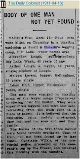
Recently I came across an article from 1911, here it is:
Transcribed here:
 16 April 1911 The Daily Colonist,(Victoria)

BODY OF ONE MAN NOT YET FOUND

Vancouver, April 15.―Four men were killed on Thursday in a blasting explosion at Small & Bucklin's logging camp, Pitt Lake. Their names are:
Alexander Lough, superintendent, Big Lake, Washington, 43 years of age.
Arthur Lough, a logger, 19 years, single, nephew of Lough.
Melvyn Larsen, logger, Bellingham, 35 years, single.
Adam Hein, logger, Bellingham, 35 years, single.

The men were engaged in blasting some of the larger snags preparatory to closing down for Easter. They were experienced loggers, and were last seen retreating from the train fuse to a place of safety. It is believed that the explosion, being unduly protracted, they returned too soon and met their deaths.
The bodies of the first three named were found horribly mutilated. That of Hein had not been found up to last night. Constable Wilkie, of the Provincial police, proceeded on the company's tug up the Fraser, and returned this morning with the remains.

The strangest thing about this event is the fact that even though the police were involved, none of the deaths were registered in British Columbia ! I frequently run across  this problem, but never on this scale with four dead men.
 ---o---

The Phoenix Pioneer, January 4, 1913

Bounced the Hindus

 Due in great measure to the evidence that was given, at the recent trials for perjury in New Westminster, the management, of the Small & Bucklin lumber mills in the Royal City have decided to dismiss every Hindu in their employment and to replace them with white labor. This decision was arrived at only after long and careful consideration of the circumstances in connection with the charges.

It will effect about ninety Hindus, who resided in shacks, the property of the company. in order to make the decision all the more effective, the demolition of the shacks was commenced at once and the majority of them razed to the ground by fire.

ln the course of the evidence at the recent trials it was alleged that, in order to retain their jobs, the Hindus had been in the habit of giving bribes to certain officials, and the management were influenced in the step they have taken by this fact.

---0---

October 17, 1913

C.A. Woods and W.B. Vaughan were accidently drowned while booming logs for the Small and Bucklin Lumber Co., at Pitt River.       Also not registered at BC Archives.

and on, and on...

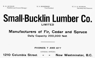
AD from 1914 in the Henderson Directory

AD from 1908

This is just a little taste of what I have about the Company and its history.  And Yes, Bucklin Creek, in the Upper Pitt River is named after Edgar H. Bucklin. In their operations in the Pitt watershed I have lost count of how many died getting the wood to the mill,  must be over twenty.
Small & Bucklin sawmill with stacks of lumber, buildings. ca. 1920.
New Westminster Archives       IHP0958
The sawmill was located at 1210 Columbia Street, New Westminster. Today in 2013 it is all residential


Two Fraser River views. VPL 6892. date: 1910, photo: Philip Timms.
TOP:  Probably looking west along the Fraser, unknown buildings on the left,
                    possibly Poplar Island on the right.
BOTTOM: Small & Bucklin sawmill, at the western end of New Westminster.

View of New Westminster, looking towards Lulu Island.
VPL 13735 date: ca.1912, photo R. Broadbridge.

View of Bucklin Lumber Co. Ltd.
  VPL 11381   date:1921, photo: Leonard Frank.
Maps of the area

Maps that cover Burke-Pinecone Provincial Park, and surrounding areas. These maps are in 1: 50 000 scale, except for the geology maps.) These are all fast links to their Geoscan pages, from Natural Resources Canada, just click on “more”, which will open up a larger listing of options to the different map options, Geopdf are digitized pdf’s which allow you to customize the layers, and create your own maps. They all download in their own separate zip formatted folders, just open the folder and drag the map onto your desktop.
Vancouver North, Coquitlam, and Pitt Lake map Areas, British Columbia With Special Emphasis On the Evolution of the Plutonic Rocks; Roddick, J A. Geological Survey of Canada, Memoir 335, 1965, ; 276 pages.
( Three maps and three drawings are included in a zip file of the entire book.)

Port Coquitlam, BC , NRC. Canadian Topographic Maps 92G/7, (edition 7) 2009

Port Coquitlam, BC, NRC. Canadian Topographic Maps 92G/7, (edition 6) 2002

Geology Coquitlam, BC; Roddick, J A. Geological Survey of Canada, "A" Series Map 1153A , 1965

Pitt River, BC, NRC. Canadian Topographic Maps 92G/10, (edition 4) 2009

Pitt River, BC, NRC. Canadian Topographic Maps 92G/10, (edition 3) 2002

Geology Pitt Lake, Vancouver, East Half, BC; Roddick, J A; Armstrong, J E. Geological Survey of Canada, "A" Series Map 1151A , 1965

Mamquam Mountain, BC, NRC. Canadian Topographic Maps 92G/15, (edition 4) 2009

Mamquam Mountain, BC, NRC. Canadian Topographic Maps 92G/15, (edition 3) 2002

Stave River, BC, NRC. Canadian Topographic Maps 92G/9, (edition 5) 2009

Stave River, BC, NRC. Canadian Topographic Maps 92G/9, (edition 4) 2002

Glacier Lake, BC, NRC. Canadian Topographic Maps 92G/16, (edition 4) 2009

Glacier Lake, BC, NRC. Canadian Topographic Maps 92G/16, (edition 3) 2002

Squamish, BC, NRC. Canadian Topographic Maps 92G/11, (edition 4) 2009

Squamish, BC, NRC. Canadian Topographic Maps 92G/11, (edition 3) 2003

New Westminster, BC - Canada - United States of America, NRC. Canadian Topographic Maps 92G/2, (edition 7) 2009

New Westminster, BC - United States, NRC. Canadian Topographic Maps 92G/2, (edition 6) 2003

Pitt Lake legends videos

I personally do not believe in any of it, the Mitchell bomber site and the wreckage, should be left alone as a memorial to the crew who died there.

Mitchell Bomber Part 1 --- Part 2

Nazi gold Part 1 --- Part 2

Seekers of gold Part 1 --- Part 2

And a website devoted to putting to rest the myth of Slumach

One of a set of raw video about the curse of Slumach Item : MI-475 - Lost Mine - tape 18
original raw footage for "Curse of the Lost Gold Mine." Includes an interview with John F. H. Thompson, a geologist at UBC, who talks about the geology of Pitt Lake, shots of a map of Pitt Lake and Michael Collier plotting out a route on the map, also includes an interview with Mike Boileau, who has been looking into finding gold in the Pitt Lake area since 1979, he talks about the curse, the stories of Pitt Lake, and his own experiences at Pitt Lake.
This video is part of the Series S4 - Curse of the Lost Gold Mine series located at the Vancouver Archives.